Visiting Death Valley National Park

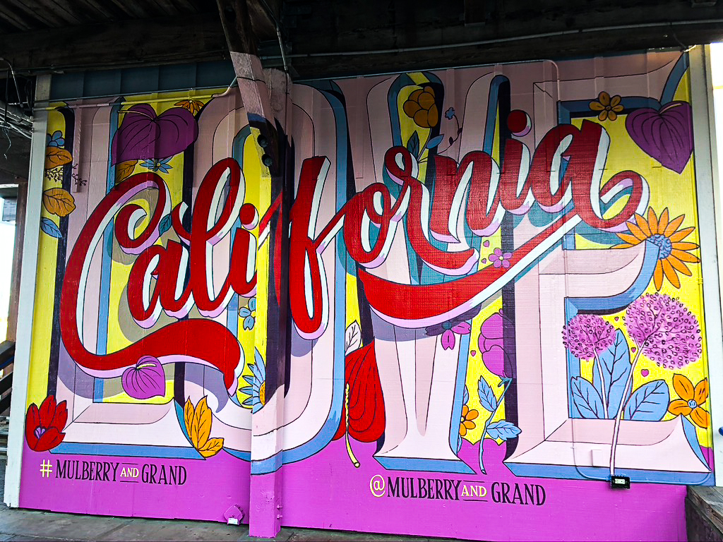
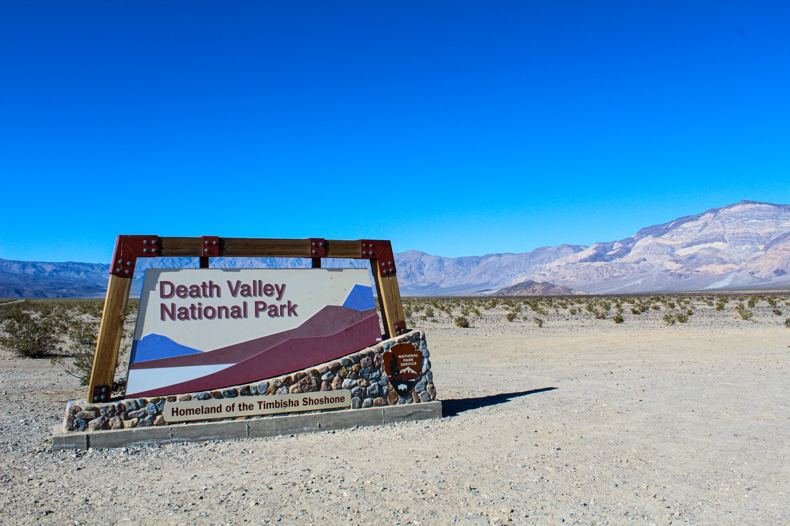
In my previous post I talked about the first half of my California trip which was centered around traveling to San Francisco for a wedding. While planning what we were going to do in California I knew that I wanted to take advantage of being on the west coast and do something or visit somewhere new after the wedding and eventually decided on visiting Death Valley National Park. Before the trip and in San Francisco kept asking why Death Valley. Honestly it came down to really wanting to visit another national park and wanting to avoid snow which eliminated northern California and higher elevations. With Death Valley National Park being known for its extremely hot summers, an opportunity to visit in February seemed perfect.

The day we arrived in Death Valley we were coming from Bakersfield which was just over a three-hour drive. We had got a bit of a late start with our day so by the time we made it into the park and got our pass we headed straight to The Ranch at Furnace Creek where we were staying. After checking in and dropping our stuff we took a walk around the Furnace Creek area to check out what was around and ended up eating dinner at the restaurant by the golf course. While the menu was small and the food was pretty basic, watching the sunset across the golf course was a nice way to end a travel day.   

view on the west side of Ubehebe Crater
Ubehebe Crater | Looking West
old stovepipe wells
Old Stovepipe Wells

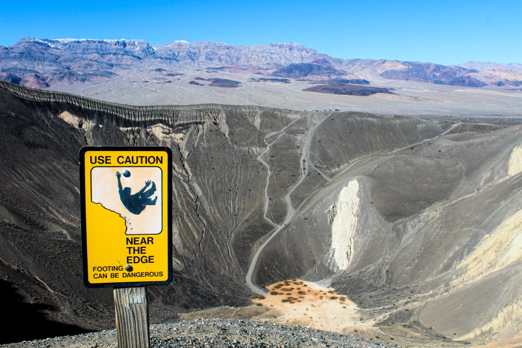
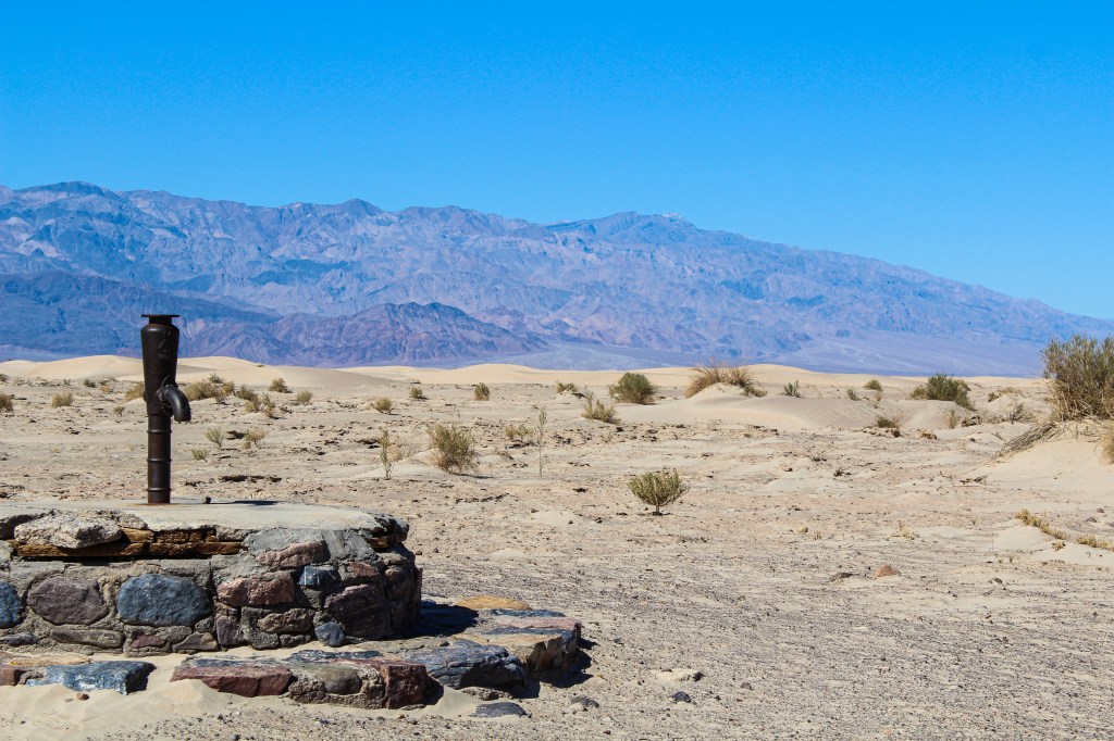
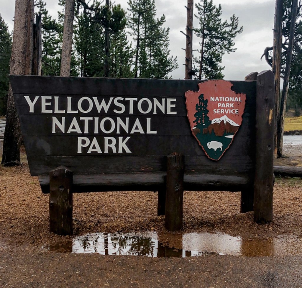
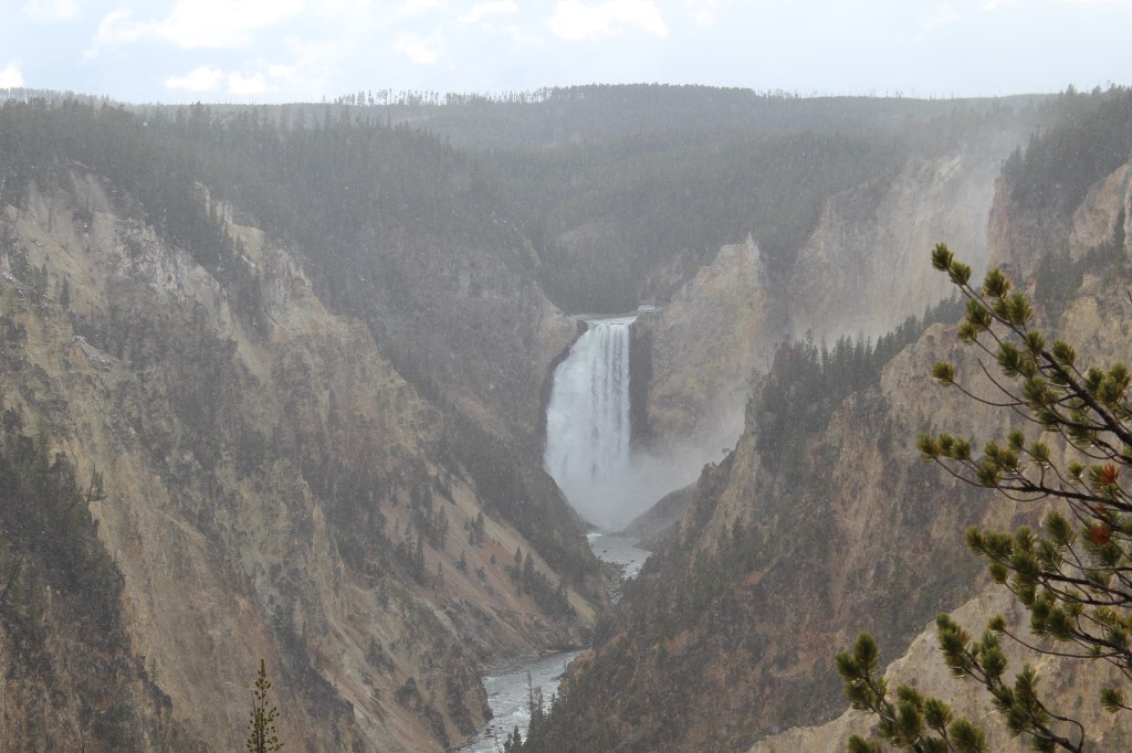
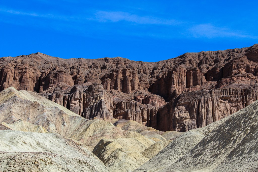
On our first full day in Death Valley we woke up and decided to head to Ubehebe Crater which was about an hour drive from Furnace Creek. When we arrived at the crater there were only a few other cars in the parking lot, which when compared to our experience in Yellowstone was surprising to us. The Ubehebe Crater is a 600 feet deep, half a mile wide, maars volcano created when hot magma rising up from beneath the ground came in contact with ground water, causing water to turn into steam and gas eventually resulting in a large explosion. We decided to do the 2-mile Rim Trail, along the edge of the crater. The trail is relatively easy but thee ground is a sandy consistency and there is a 270ft incline on the west side so it isn’t the easiest trail. But with that being said I wouldn’t go as far as to categorize it as moderate or difficult. The trail, as well as the entire Ubehebe Crater area, was pretty quiet with only two or three other groups around at one time. After spending about an hour or so at the crater, we headed south towards Badwater Basin. The only pit stop we made along the way was to the old stovepipe wells. The old stovepipe wells display is really just a plaque located at the end of a dirt path off of Scotty’s Castle Road. The plaque marks the only waterhole in the sand dune area which was the junction of two Indian trails commonly used during the time of Rhyolite and Skidoo. The old stovepipe well was the only known water source on the cross-valley road and is now a California registered historical landmark.

salt flats at badwater basin
Salt Flats at Badwater Basin
natural bridge trail
Natural Bridge Trail

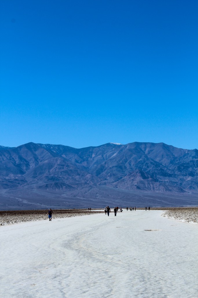
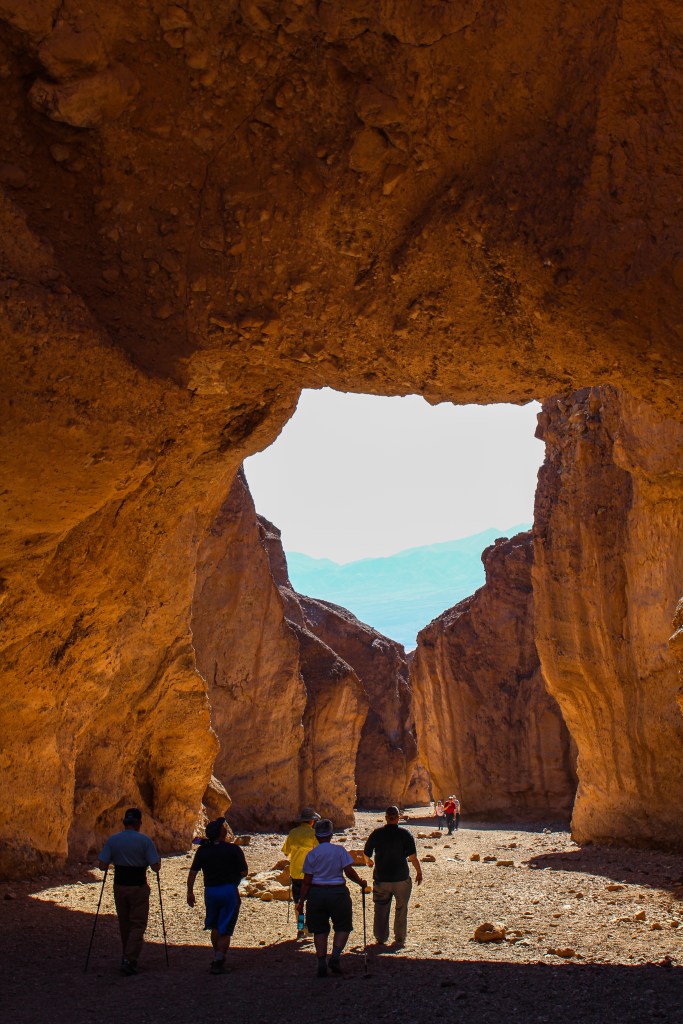
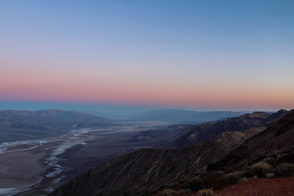
Nearly an hour and a half later we made it to Badwater Basin, the lowest point in North America. The salt flat basin sits at 282 feet below sea level. It is only a short walk from the parking lot out to the salt flats which is an almost unreal and unique landscape. After spending about 30 minutes walking around the salt flats we made our way back to the car and worked our way slowly back towards Furnace Creek. On the way north, we stopped at the Natural Bridge Trailhead. While the natural bridge trail was the same length as the Ubehebe Crater Rim Trail I would say that it is a bit more challenging because the natural bridge trail is gravel and uphill. While the entire Natural Bridge trail is one mile each way, the natural bridge rock formation is only half a mile into the trail. It was at the Natural Bridge trail was by far the busiest place we experienced during our visit, with a tour bus even stopping to do the hike. I remember at one point, standing in one place for about 10 minutes trying to get a certain picture without any people in the frame; with how busy the trail was in February I can’t imagine what it would be like during the summer.

devil's golf course
Devil’s Golf Course

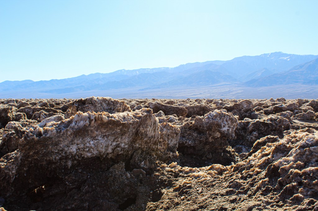
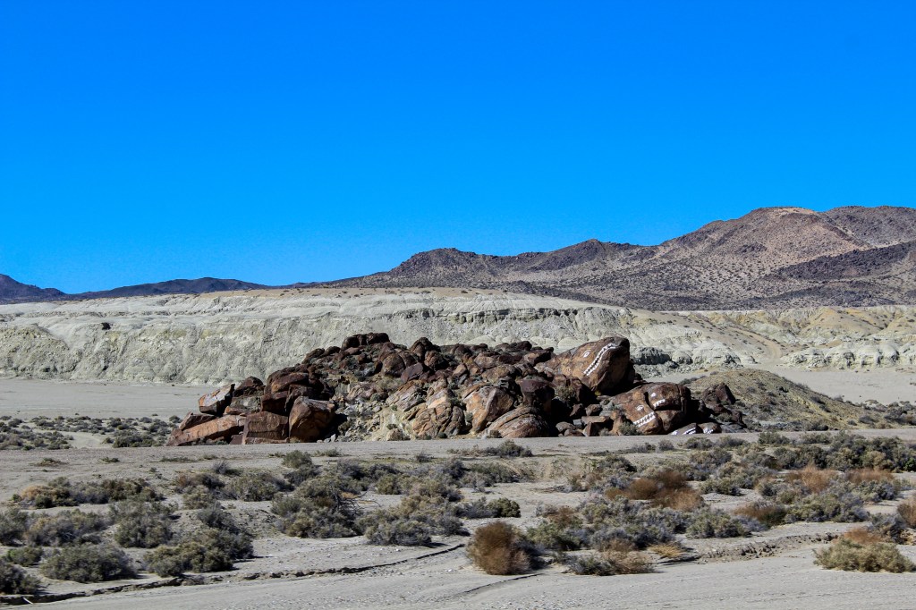
Our next stop was to Devil’s Golf Course which if your time in Death Valley is limited, I would say it isn’t a must see because it is a lot like the salt flats at Badwater Basin. Devil’s Golf Course got its name from a 1934 National Park Service guidebook to the then Death Valley National Monument, that stated, “Only the devil could play golf on such rough links.” The rough surface is a result of large halite salt crystal formations. During warm temperatures you can even hear popping coming from the ground, as a result of the billions of tiny salt crystals bursting apart as they expand and contract in the heat. I would say that at most we spent five minutes at Devil’s Golf Course before leaving to head to Artist’s Drive.

Artist's palette in the afternoon sun
Artist’s Palette in the Afternoon Sun

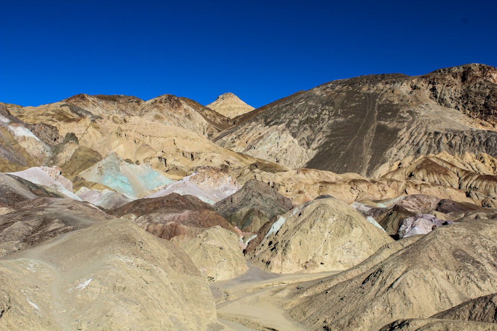
Artist’s Drive is a nine-mile one-way drive through the canyons. Unlike the Twenty-Mule Canyon Drive, which I will get to later, the Artist’s Drive has plenty of places to pull off and get out of the car to walk around and take photos. The main stop along the nine-mile drive is Artist’s Palette, about five miles in. The multicolored hills at Artist’s Palette are truly extraordinary. The variety in colors are a result of mineral oxidation from the deposit of volcanic ash and minerals on the area millions of years ago. While you can see the colorful hills right from the parking lot, you can also walk around and climb the hills in the area, thanks to Death Valley being a free hike area.

sunset at Zabriskie Point
Sunset at Zabriskie Point

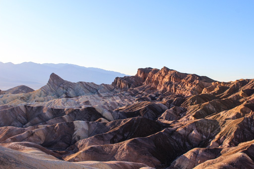
After finishing Artist’s Drive, we headed to Zabriskie Point for sunset. Zabriskie Point is the most famous viewpoint in the park. To get to the outlook you park in a relatively small parking lot and then walk up a paved incline to the viewpoint, which makes it totally accessible. The viewpoint definitely got busy as sunset drew closer, especially in the number of amateur photographers with their cameras and tripods. I would say that unless you specifically want to see Zabriskie Point at sunset, there are other less busy locations that provide the same sunset experience. After watching the sunset, we headed back to The Ranch at Furnace Creek where we simply grabbed a bunch of snack type items from the general store for dinner.

view of Death Valley at sunrise from dante's view
View of the Valley from Dante’s View at Sunrise
sunrise at dante's view
Sunrise at Dante’s View

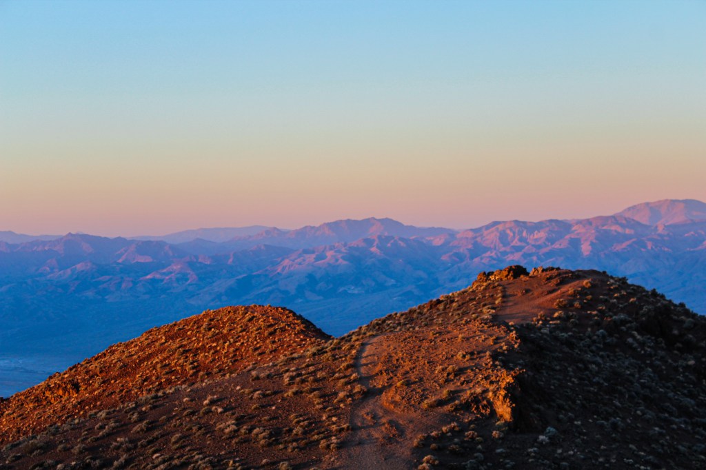
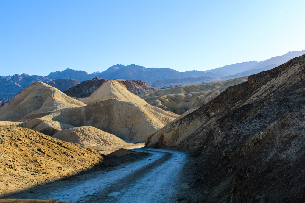
Sunrise the next morning was at 6:23 a.m. (PST), so we got up around 5:15 a.m., quickly got in the car and made it to Dante’s View before 6 a.m to see the sunrise. When we got there, there was only one other person around and even by the end only two other people joined us, which leads me to highly recommend getting up early for sunrise because it was a much more enjoyable experience than the busy sunsets I experienced. Our sunrise experience at Dante’s View was an incredibly tranquil experience but also invigorating because we got to see the light emerge from behind the mountains and watch entire area slowly “come alive.” After watching the sunrise from Dante’s View we headed to the Twenty-Mule Team Canyon Drive. The canyon was used from 1883 to 1889 by mule teams as a means to transport borax from the Harmony Borax Works near Furnace Creek to the railhead in Mojave. Due to the conditions of the road the 165-mile trip took 10 days to complete.  Today the canyon drive is a 2.8-mile one-way dirt road. Sadly, the drive doesn’t have any pull offs which makes it a bit difficult to enjoy the view and take photos, especially if there are cars behind you. Since it was so early in the morning, we were lucky and there were only two other cars around making it a more enjoyable experience.

Twenty-mule team canyon drive
Twenty-Mule Team Canyon Drive

After the Twenty-Mule Team Canyon Drive we headed back to The Ranch and ate breakfast at the buffet, which honestly was not great and would recommend trying to avoid unless you run out of other options. After breakfast we headed back to the room to take a little nap and get some work done. After our mid-morning break, we wanted to head to the Keane Wonder Mill and Mine, but found the area temporary closed due to safety hazards. Instead we headed to the Rhyolite ghost town, which had us crossing the border into Nevada.

Speeltheater Holland Studio Puppets in Rhyolite
Speeltheater Holland Studio Puppets
Cook Bank Building in Rhyolite
Cook Bank Building
Porter Brothers Store in Rhyolite
Porter Brothers Store

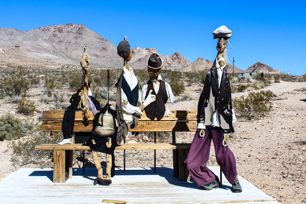
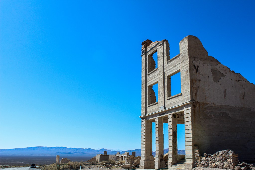
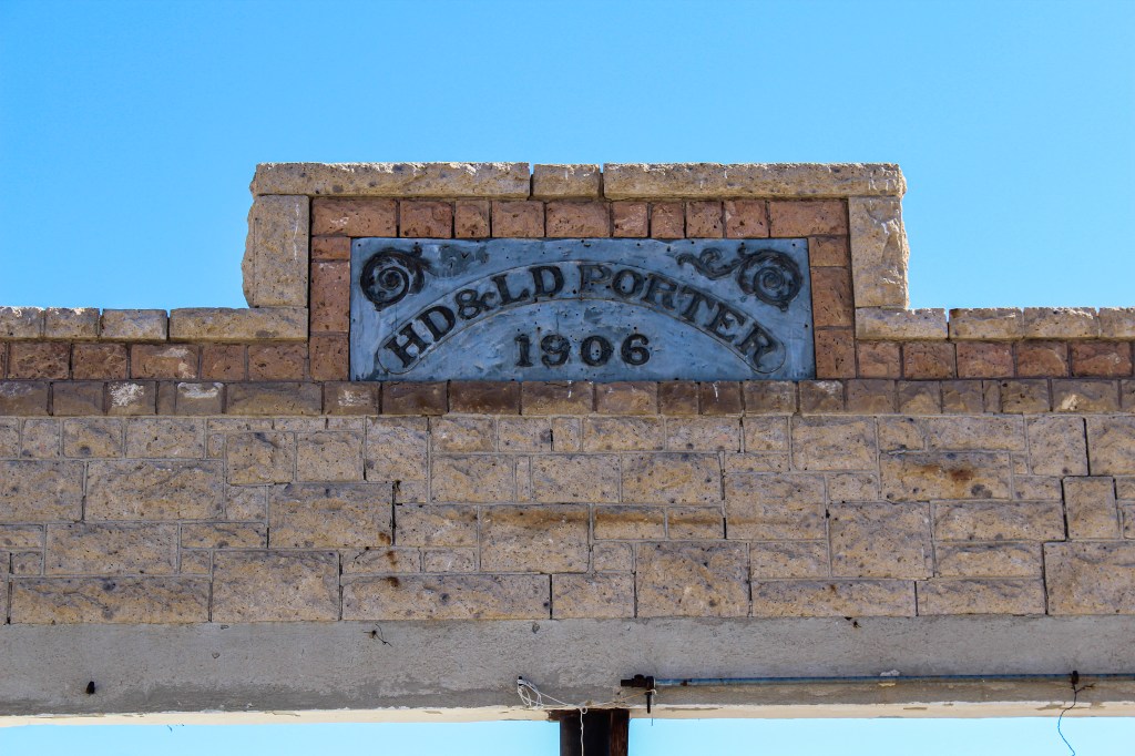
After gold was discovered the year before, the town of Rhyolite was founded in 1905 and like many other old mining towns quickly became a place of prosperity but also greed. By 1906, the town was thriving thanks to indoor plumbing, electricity and other modern luxuries. A short four years later the mines began to fail forcing people to move on, leaving the town behind. If you visit the town today, very little of the town actually remains due to buildings having been either moved to other towns or looted for materials. Our first stop in Rhyolite was to the Goldwell Open Air Museum, which is a sculpture museum with many unique and thought provoking installations. I would say that the main feature of the town is the Tom Kelly Bottle House which was built in 1906. The house is a three-room building that was built to be raffled off as a family residence and most recently has been used as a collectables shop. After spending time looking at and walking around the bottle house we drove the little loop of the town, simply just seeing the remnants of the buildings from the car. After our time in Rhyolite we did a big loop back through Beatty, Amargosa Valley and then down to Death Valley Junction, along the way we stopped at the Ash Meadows National Wildlife Refuge

Crystal Reservoir
Crystal Reservoir
Crystal Springs Boardwalk

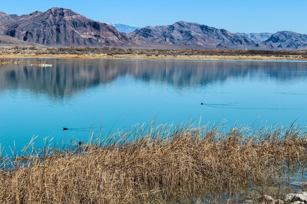
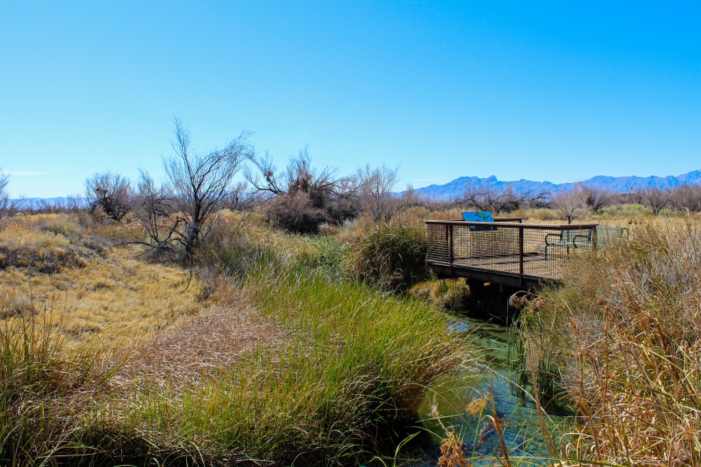
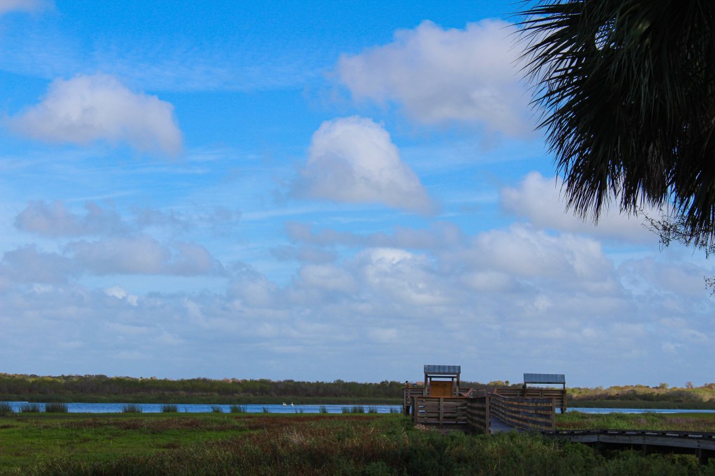
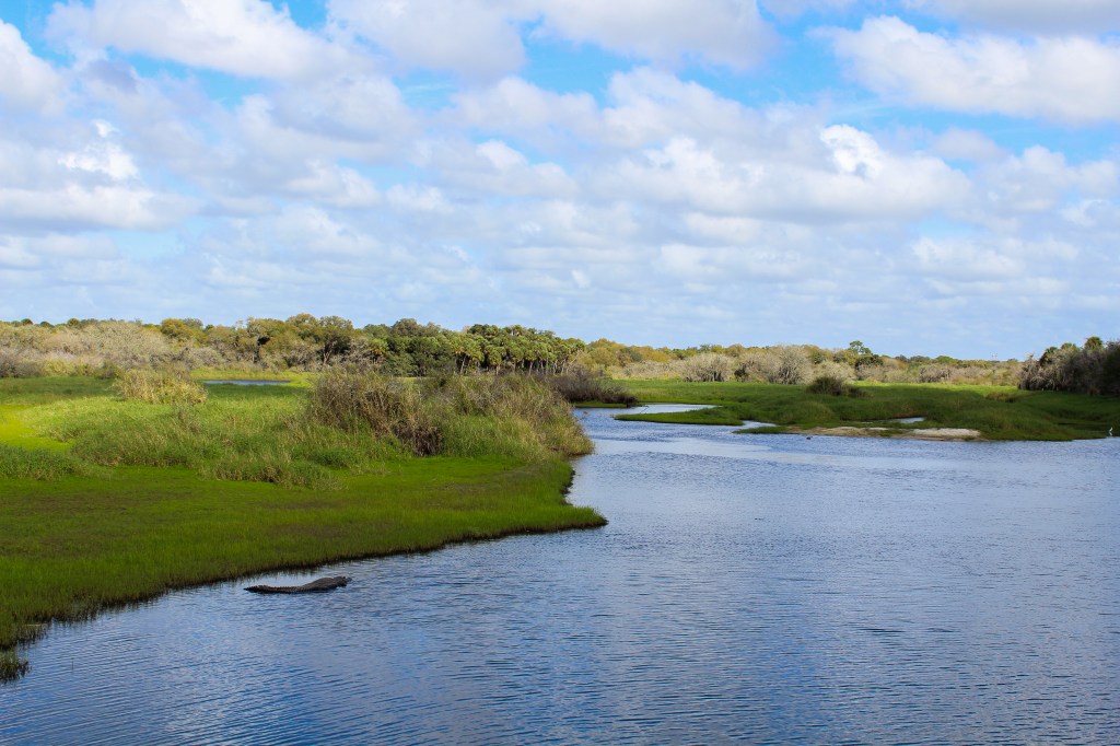
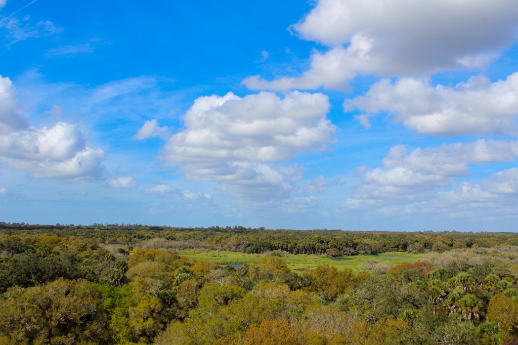
I would have to say that Ash Meadows National Wildlife Refuge was one of my favorite parts in our Death Valley experience. The area is truly incredible because you can experience the arid desert right next to such a diverse wetland area. The Ash Meadows National Wildlife Refuge was established on June 18, 1984. The refuge protects and is full of rare native wildlife, many of which are unique to the area and don’t exist anywhere else in world. Our first stop in the refuge was to the Visitor’s Center where we met a lovely volunteer who gave us a quick introduction to the area, told us what roads were currently closed due to a bad storm and what route he recommended we take. After giving us all the information we needed, he started a video for us about the refuge in the Visitor’s Center classroom. After watching the video we headed out to the boardwalk out behind the Visitor’s Center. I would say that if you want to visit Ash Meadows National Wildlife Refuge but don’t have a ton of time the Visitor’s Center boardwalk is a good showcase of what the refuge has to offer. After the boardwalk we visited the Crystal Reservoir, Devil’s Hole and then finally the Point of Rocks picnic area and trail. After spending almost three hours exploring the refuge, we headed back into Death Valley to watch the sunset at the Mesquite Flat Sand Dunes. I would say that sunset at the sand dunes was busier than at Zabriskie Point but it’s a larger area, so it didn’t seem as bad. I wanted to find a spot where I was relatively alone and where there weren’t other people close by so I kind of took off and left my mom behind. I ended up sitting at the top of a sand dune alone just taking in beauty and sereneness of the moment. A little tip I learned during my sand dune experience, when trying to walk down a tall sand dune pretend like you are walking down a set of stairs to lower your chance of falling.

Red Cathedral from Golden Canyon Trail
View of the Red Cathedral in the Distance from Golden Canyon Trail

The next morning we were leaving Death Valley, but before we headed towards Las Vegas we headed to the Golden Canyon Trailhead which is one of the most popular trails in the park. The Golden Canyon Trail has a variety of different hike options and loops that can take you on anywhere from a 2.5-mile to 4-mile hike. Since it was our last day and we still needed to make it to Las Vegas in decent time we decided on the hike to Red Cathedral, which was about 2.5 miles roundtrip. The hike to Red Cathedral is definitely a more moderate hike. With that being said the incline is gradual unlike the Natural Bridge Trail, but to actually get into the Red Cathedral at the end you have to climb over, under and squeeze through some rock formations, so it isn’t for everyone but still very doable for both myself and my mom. The views, especially on the way back, are gorgeous and walking through the golden colored canyons was an awesome way to end our experience in the park. After getting back to the car we headed out of the park and drove to Las Vegas. I have to mention, it was a bit of a weird going from spending three days secluded out in the desert straight into to the in your face nature of Vegas. We had just visited Vegas in September, five months prior, so it was kind of weird being back so soon. When we got to Vegas, we checked into our hotel, showered, got ready for dinner and then headed to return our rental car, so we wouldn’t have to deal with it in the morning. After dropping the rental car at the airport, we took an Uber to old Vegas to eat dinner and see the Viva Vision Light Show at the Fremont Street Experience. We had wanted to see the light show during our previous visit, but we had run out of time so it was the only real plan we had going into the night. After seeing the light show, we headed to the Bellagio for dessert because we had stayed there in September and knew what the hotel had to offer. After getting a honestly mediocre desert from the Bellagio Patisserie, home to the World’s Tallest Chocolate Fountain, we watched the hotel’s famous water show before heading back to our hotel because we had an early flight the next morning.

Telescope Peak at sunrise
Telescope Peak above Badwater Basin from Dante’s View

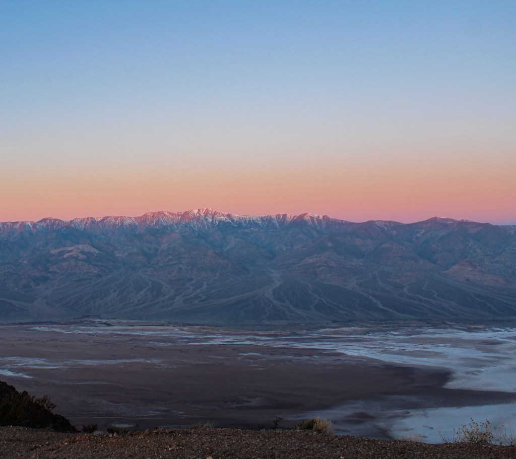
Overall, my Death Valley experience was definitely not what I imagined. I mean I don’t know exactly what I expected going into the trip, but the juxtaposition of the desert between two mountain ranges still blows me away when I look at pictures. When people think of Death Valley I think they only think of complete desert and extremely hot temperatures, but in reality that is only one part of the park. For instance, when watching the sunrise from Dante’s View, at 5,475 ft above sea level, you can see Badwater Basin, at 282 feet below sea level, as well as the snowcapped Telescope Peak, at 11,049 feet, all while standing in the same spot. Death Valley National Park has a variety of landscapes from salt formations and alluvial fans to sand dunes and badlands. When it comes to the weather in the park, while I can’t imagine visiting in the summer, we experienced everything from below freezing temperatures while watching the sunrise at Dante’s View to temperatures in the mid 80s while hiking Golden Canyon during our three-and-a-half-day visit. Death Valley National Park is one of those places I just know I will visit again. There are so many places and activities we didn’t have the opportunity to see or do. I truly believe Death Valley National Park is a place that everyone should visit at least once.


Missed my blog on the first half of my California trip. Click here to check it out.

My trip to California was my last trip before coronavirus and due to the virus all future travel is currently paused. But I can’t wait to see where my next adventure takes me. In the meantime head on over to my Instagram @YourBackyardTourist for more content during this very weird time.

San Francisco

Looking back at our trip to California it was all kind of a whirlwind, in one suitcase I had business casual clothes and active wear for outdoor activities as well as a full-length formal dress and hiking shoes. In the span of ten days, we did pretty much everything from exploring San Francisco and attending a work event to a family friend’s wedding and Death Valley. Plus, all of this was going on at a time when COVID-19 was beginning to make daily international headlines but hadn’t started to influence daily life in the United States yet.

Pier 39 Sea Lions
Pier 39 Sea Lions

I was headed to California with my mom (who happens to be my go to travel buddy) so I decided to fly from Florida to New Hampshire a mere 10 hours after landing from my weekend in New Orleans (see my last post for more on that trip) before then flying with her from Boston to San Francisco less than two days later. We landed in San Francisco around noon on Wednesday, picked up the rental car (which we would need for the second half of our trip) and drove into the city. We dropped off our luggage at the hotel before heading out to explore the area. We ended up walking down to the water to the Ferry Terminal and Pier 7 and then decided to walk down to Fisherman’s Wharf to check it out. By the time we made it to Fisherman’s Wharf we were getting hungry but knew we didn’t really want to eat at a chain restaurant, so we decided to keep walking and eventually make it to Scoma’s Restaurant for dinner. My mom used to eat at Scoma’s whenever she was in San Francisco for work, so she was excited to show me somewhere she used to go regularly. After a delicious meal at Scoma’s and still being on east coast time we decided to head back to the hotel for the night.

Powell-Hyde Streetcar Line

The next morning my mom had to work so I woke up when she left, worked out, ran across the street to Starbucks for breakfast, got some schoolwork I needed to finish done and then got ready for the day. I had been left with a list of errands, so I spent the majority of my afternoon adventuring around San Francisco’s financial district getting everything done on the list. Then around 5 p.m. I headed back to the Ferry Terminal to The Slanted Door to meet my mom and people from her work for a happy hour/dinner. The next morning was our day to explore San Francisco so we woke up early, got ready and headed from our hotel through Chinatown to Mama’s on Washington Square for breakfast. We couldn’t have gotten to Mama’s more than 20 minutes after they opened, but there was already a line out the door. Even though the line was out the door we didn’t have to wait too long and the food was worth it, I mean nearly two months later I’m still mad at myself for trying to be healthy and not getting the French toast even though it looked delicious. After breakfast at Mama’s we walked to the cable car museum, which I highly recommend. I found it fascinating that the cable cars today are still running the same way that they have run since they began. After the cable car museum, we felt as though it was only fitting to then ride a cable car and ended up riding the Powell-Hyde line all the way down to Ghirardelli Square. The one thing to note about the cable cars is that they are exact cash only for buying tickets but there is an app you can use if you don’t have cash and want to pay with a credit card. Instead of actually adventuring around Ghirardelli Square we instead walked along the water, around the San Francisco Maritime National Historical Park and then checked out the Maritime Museum. There isn’t a ton to see at the Maritime Museum but it’s free so it’s worth checking out if you have the time. Plus, if you’re into architecture the design of the building itself is pretty cool. After the Maritime Museum it was time to head back to the hotel and pack up the rental car before driving across the Golden Gate Bridge to Cavallo Point Lodge in Sausalito where we were spending the next two nights of our trip and where the wedding was going to be. We ended up spending Friday afternoon just relaxing and hanging around Cavallo Point before having dinner at the restaurant on site with some friends.

Golden Gate Bridge view from Vista Point
Golden Gate Bridge View Vista Point
Muir Woods, coastal redwoods surrounding path
Wandering Through Muir Woods

I had looked at what there was to do around San Francisco before the trip and knew that at some point I wanted to check out Muir Woods. So, Saturday morning we woke up early and reserved a spot on a shuttle to Muir Woods, since all the on-site parking had already been reserved. Which if you are planning on visiting Muir Woods make sure you are aware that on-site parking is limited and has to be reserved ahead of time. We decided to get breakfast on the way and ended up stopping at the Sausalito Bakery and Café, which was easy because it was before 9 a.m. on a Saturday morning so there were a ton of available parking spots right outside. We happened to get to the parking lot where the shuttle picked up right as one was getting ready to leave so the timing could not have been better and the entire shuttle situation couldn’t have been easier. Once we got to Muir Woods there were a lot of people around, most of which who were using the area as their local park for a Saturday morning family walk. Due to the amount of people around it was nearly impossible to escape the noise of people talking which was a bit disappointing given the environment we were in. After spending about two hours exploring Muir Woods it was time to catch the shuttle back to Sausalito. On the way back to the hotel we ate lunch at the Barrel House Tavern out on the patio overlooking the ocean which in the beginning of February was a bit chilly but still beautiful. After lunch we headed back to the hotel to get ready for the wedding which ended up being incredibly beautiful, moving and so much fun.

Pigeon Point Light Station State Historic Park

The morning after the wedding we woke up, slowly got ourselves ready, packed up our stuff, got it all into the car and headed out of the Bay Area towards Bakersfield on our way to Death Valley. We had the entire day to drive to Bakersfield, so we decided to take the long way along Route 1/Pacific Coast Highway. We ended up having breakfast in Pacifica at the High Tide Cafe and got a coffee next door at Soul Grind Coffee Roasters before hitting the road again. On our trip south we didn’t really have any thing planned so we just stopped whenever we saw something interesting so along the way we stopped at the Pigeon Point Light Station State Historic Park in Pescadero and drove through downtown Santa Cruz. For our dinner on the road we ended up stopping at some random In n Out because I need to have it at least once whenever I am on the west coast and that was going to be my only opportunity to do so. Eventually we made it to Bakersfield and ended up crashing for the night. The next morning, we walked to the 24th Street Café for a quick breakfast before getting back in the car and heading towards Death Valley.

Fish Rocks in Salt Wells Canyon, California
Fish Rocks | Salt Wells Canyon, CA

Stay tuned for my next blog post all about our time in Death Valley, in the meantime check out my Instagram @YourBackyardTourist for more photos from my travels.

Weekend in New Orleans

Prior to my trip in February I had visited New Orleans three times before and had experienced many sides of the city. From helping reopen a park, clearing lots in the Lower Ninth Ward and listening to the stories of first responders after Katrina to eating beignets at Cafe du Monde, taking an airboat ride through the swamp and parading through the French Quarter behind a jazz band with a police escort, I had previously experienced the city, its culture, and the resilient people that call it home. But on this trip, I was able to take part in one thing that I had yet to experience and that was Mardi Gras!

seats inside the st. charles streetcar
St. Charles Streetcar

I landed in New Orleans Thursday night and got picked up by my friend whom I was visiting. It’s worth noting that the new terminal at MSY had opened up only three months earlier when I arrived the airport’s passenger pickup and Uber/taxi system was complete chaos with no one really knowing where they were supposed to be. Once we escaped the chaos of the airport, we drove to my friend’s house, dropped off my stuff and then walked to dinner at Rum House where we had delicious tacos and margaritas before calling it an early night. After having a chill morning around the house, we walked to Turkey & the Wolf at the end of the block for brunch. Turkey & the Wolf was actually named America’s best new restaurant by Bon Appétit in 2017 and I would definitely agree with their description of the restaurant’s vibe being “basement hangout”. I ended up ordering the cauliflower sandwich with had roasted cauliflower, tomato goat cheese and basil on it among other things, which was delicious and would 100% get again. We then decided to take a streetcar over to the Tulane campus so that my friend could take a photo to celebrate getting into grad school there. Overall, the streetcar was super easy to ride, you simply use an app to purchase a ticket and then you are good to go. While riding the streetcar we learned that as of 2014, the St. Charles streetcar line was a designated national historic landmark. Once we got the photos taken at Tulane, we headed across the street and walked through Audubon Park in order to get to the Audubon Zoo. We got to the zoo kind of late not knowing that it closed at 4 p.m. But with just over 2.5 hours in the zoo we were still able to see pretty much everything we wanted.

one of the countless floats from the Krewe of Cleopatra
Krewe of Cleopatra

After the zoo, we were able to catch a bus to Urban South Brewery before the bus routes were altered due to the night’s parades. After both getting a flight and po-boy for dinner at Urban South, we headed back home to break out the fanny packs, pack them with roadies for the night and headed up to St. Charles Ave for the night’s parades. I think there were three krewes having their parades that night, but once we found a spot it was one continuous party until the end. Our first night of parades ended with both of us complaining of back pain because we had so many beads around our necks and both having acquired backpacks that we had completely stuffed with throwaways we had caught, like light wands and stuffed animals. To put the cherry on top for the night we found a completely unopened case of Truly on our way home, which made the night even more ridiculous than it had already been.

image of myself after the first night
My night one haul
Molly's rise and shine neon sign
Molly’s Rise and Shine
grand slam mcmuffin from molly's rise and shine
My Grand Slam McMuffin

The next morning, we got up and walked to Molly’s Rise and Shine for breakfast where I got the classic Grand Slam McMuffin, which is an english muffin with sage pork patty, hash brown, griddle onions and American cheese. I also got a homemade pop tart, I mean who can resist homemade pastries, and a side order of hash browns to spilt. We ended up spending the majority of our Saturday at a friend of a friend’s house super close to the parade route, where we just hung out, drank and played with their dog while in between walking up to watch some of the parades go by. At some point we were all hungry so we went and got dinner at The Avenue Pub while there was a break in the parades. I ended up getting the classic Pub Burger with Swiss cheese which was exactly what I needed at the time and after even more parades our night ended with some pizza and an episode of Love is Blind, because it had just come out at the time and we were obsessed.

image of two dogs, both dressed as lobsters, on top of a float made to look like a fishing boat
Simply one of the countless adorable participants of the dog parade

Sunday morning, we woke up and eventually headed to Stein’s Market & Deli for some amazing breakfast sandwiches and a coffee from the Whatever Coffee pop-up inside. After which we met up with my friend’s boyfriend and his friends and took an Uber down to the French Quarter for the dog parade. I think the dog parade might be one of the most adorable things I will ever see in my life. After the cuteness overload of the dog parade, we headed to All Relation Brewing, which I would describe as a brewery with a local wine bar vibe. Before I knew it, it was time to head back to my friend’s house to grab my stuff, head to the airport and fly home but not before getting Shake Shack for dinner at the airport which had been on my mind the whole weekend.

Head on over to my Instagram @YourBackyardTourist for more photos from my trip and stay tuned for more blogs about my travels.

Fort De Soto County Park | St. Petersburg, FL

fort de soto batteries and military post historical marker

You ever wake up and feel like you just don’t want to do what you should. That is what happened to me one morning in January. I woke up and just knew I wasn’t going to be able to motivate myself to do schoolwork so instead of the day being a complete waste I decided to go check out Fort De Soto Park. Unlike Myakka River State Park, Fort De Soto Park is operated by Pinellas County and is the largest park within county’s system. The park is spread over 1,136 acres and five connected islands: Madelaine Key, St. Jean Key, St. Christopher Key, Bonne Fortune Key and Mullet Key. The land the park sits on was originally inhabited by the Tocobaga Native Americans. In 1539, Hernando De Soto, the park’s namesake, landed in the southern portion of Tampa Bay launching Spain’s eventual conquest of Florida. In 1849, a group of US Army engineers, including Robert E. Lee, recommended that the area be fortified to help defend against attacks from sea. During the Civil War the land was used to help the Union blockade of Tampa Bay. In 1900, Fort De Soto officially got its name when it became a subpost of Fort Dade which was located on nearby Egmont Key. Actual construction of the fort began in November 1898 and finished in 1906. In its entirety the fort consisted of 29 buildings including, barracks, hospital, guardhouse, blacksmith and carpenter shop and an administration building among others. While the fort was finally completed in 1906 it was only active until 1910 when the majority of troops were moved to Fort Morgan in Alabama, with mosquitoes and the summer heat being the main motivators in decision to move elsewhere. By 1914, only two people remained at the fort, a sergeant and a game warden both in caretaker roles. In 1938, Pinellas County purchased the land for the park from the federal government for $12,500. Then in 1941, the federal government purchased the land back in order to use it as a gunnery and bombing range during WWII. Following the end of the war, Pinellas County repurchased the land in 1948 and in 1977 the park’s 12-inch mortar battery was added to the National Register of Historic Places.

fort de soto gulf pier
Fort De Soto’s Gulf Pier

Today the park offers visitors two fishing piers (one bay side and one gulf side), multiple beaches, a picnic area, campground, multipurpose trail, nature trails and even a two-mile paddling trail. From the park’s concession store, visitors can rent a canoe, kayak, bike, or surrey bike or even purchase a ticket for the ferry to Egmont Key State Park. For those interested in bird watching, the park is a gateway site for the Great Florida Birding Trail. Over 300 species of birds have been spotted in the park which has led the park to become one of the most popular birding destinations in the United States. The park’s beaches have also gained recognition in the past being named America’s Top Beach by Trip Advisor as well as being named the Best Beach for Families by USA Today and Parents magazine. During my visit I ran into people walking, running and even rollerblading along the park’s seven-mile multipurpose trail.

arrowhead picnic area - picnic table on the edge of the water
Arrowhead Picnic Area

I arrived at Fort De Soto Park around noon and paid the $5 toll to get into the park. I decided that I would make my way from one end of the park to the other. Therefore, my first stop inside the park was to East Beach and I actually ended up driving as far as I could before the road ended. There was a small beach at the end of the road just past the main East Beach that offered a unique view of the Sunshine Skyway Bridge, which happens to be the world’s longest cable-stayed concrete bridge. There were a ton of sand crabs and jumping fish in the area, which were pretty cool to sit back and watch. My next stop was to the Arrowhead Picnic Area where there was a nature trail, though my attempt at the nature trail didn’t last long. I quickly realized that I had forgotten any type of bug repellent at home which meant that as soon as I stepped outside the car, I began to be eaten alive by mosquitoes. The weird thing was that during my entire trip to the park, the only place I ran into an issue with mosquitoes was at the picnic area. Even though I pretty much ended up running through the trail I still was able to take in some of the indigenous flora and fauna as well as find a secret little spot along the water.

view of the beach from the top of Fort De Soto fort
View of the beach from the top of the fort

After my experience with the nature trail I drove along the Bay Way up to North Beach. I visited the park on a Tuesday afternoon and found the park to be relatively quiet but the more popular areas were definitely busier, I assume based on the amount of parking available, especially at North Beach, that the park gets pretty busy during the summer time. The park’s North Beach has everything you could need for the perfect beach day, including plenty of parking, relatively clean bathrooms and a decent sized food stand with seating.

fort de soto's 12-inch mortar battery
Fort De Soto’s 12-inch Mortar Battery

After checking out North Beach I headed to the historical Fort De Soto. The fort sits at the center of the park where the Gulf of Mexico meets Tampa Bay. I must say there isn’t a ton to be seen at the fort, especially if you aren’t super into history and don’t want to read every plaque. When walking around the base of the fort you can walk inside some of the old rooms like the artillery holds and firing galleys, as well as view the fort’s mortar battery cannons. You can also climb a set of stairs and walk along the top of the fort, which offers another great view of the beach and Skyway. There is also a trail across the fort’s parking lot that takes you around the entirety of the old fort site but the majority of the stops along way are just plaques that detail what building used to stand there and remnants of the foundations. The historic fort site does include the Quartermaster Museum which is housed in a reconstructed version of the fort’s postal building. The museum offers historic photos and military documents from the fort as well as artifacts from the Spanish-American War. After spending a decent amount of time walking around the old fort site, I ended my trip to Fort De Soto Park by heading back to East Beach to eat lunch at one of the picnic tables directly on the beach and spent my lunch taking in the breathtaking scenery.

east beach with sunshine skyway in the very background
East Beach

Stay tuned for more blogs about my travels and make sure to check out my Instagram (@YourBackyardTourist) for my photos from my adventures.

Footage from my time at Fort De Soto Park

Mine Falls | Nashua, NH

image of a creek flowing through the forest, with light snow covering on the bank under a blue sky

Before we were all advised to stay home and stay inside, I got the chance to go home and spend some time in New Hampshire. While I was home the weather was particularly nice for a New England winter, so one day my mom and I decided to go for a walk through a local park. While I grew up in the area, I probably hadn’t been to the park more than 10 times. The land the park sits on was purchased in 1969 in a joint effort by the city of Nashua and the federal Land and Water Conservation Fund. In 1992, the 9.7 miles of trails throughout the park became part of the New Hampshire Heritage Trail system. The park’s 325-acres includes everything from forest and wetlands to open fields. Today park visitors have the opportunity to engage in a wide range of activities like walking, fishing, cross-country skiing, and biking as well as organized sports like soccer and baseball inside the park.

While I grew up in the area and obviously knew the park’s name, I had never put two and two together that there was actually a waterfall somewhere in the park. Then on the walk with my mom in January, we decided to veer off the path we were on and down a side trail and ended up randomly coming across the waterfall. Simply happening to come across the waterfall in a park I had grown up around, reminded me that none of us have to go far to discover something new or find adventure and that we should never stop exploring, even in our own backyard.

image of a frozen pond with some snow on the ground

Myakka River State Park | Sarasota, FL

map of the park in the visitors center
Map of the park in the Visitors Center

While I have been stuck inside this past week, I have been thinking about my adventures before social distancing was the new normal.

One weekend in January I woke up and decided I wanted to go somewhere new, so I decided to head down to Myakka River State Park. While the park is only 30 minutes away from my house, I had never taken the time to visit. Myakka River State Park is one of Florida’s oldest and largest parks at 58 sq. miles. The park is full of large oaks and palm trees as well as alligators and turtles sunbathing along the riverbank. A trip to the park is sure to leave you thinking of old Florida. The park includes wetlands, prairies, hammocks and pinelands all with the Myakka River following through. The park offers visitors the opportunity to go boating, fishing, canoeing, and kayaking down the river or hiking and biking through the miles of trails and backcountry.

the birdwalk with the river in the background under a blue sky
The Birdwalk

I got to the park’s north entrance around 11 a.m. and even though it was relatively early for a Sunday morning there seemed to be a decent amount of people already in the park. The admission fee for a one-person vehicle was only $4, which is hard to beat. The first stop I made was to the park’s birdwalk. There was a lovely volunteer at the end of the birdwalk who pointed out a couple of white pelicans that were off in the distance. After the birdwalk, I drove down the length of the park’s main road to the picnic shelter near the main entrance. After checking out the information center at the park’s main entrance, I walked out behind the picnic shelter along the river’s edge. I sat down at a picnic table and watched the birds across the river. It was nice to be able to take a moment away from other people and just enjoy the outdoors.

alligator resting on the edge of the river
Alligator spotted from the bridge

After leaving the picnic shelter, I got back in my car and headed to the bridge to spot some alligators. After watching an alligator relax on the riverbank, I went hiking down a path along the river. After my 45-minute hike along the river, I decided to check out the park’s nature trail that leads to a canopy walkway and tower. The nature trail was definitely the most popular spot I visited, there was even a line of people waiting to access the canopy walkway. The view at the top of the tower was pretty incredible, but the tower was swaying a bit from the wind, so I didn’t stay up there too long. Overall the park’s nature trail is a nice 25-minute walk along a sanded pathway. After the nature trail, I headed to the Myakka Outpost which is basically the area of the park where you can find food, merchandise and can pay to rent a kayak or go on a boat tour. The final stop of my visit was the Clay Gully Picnic area where I ate lunch before heading back home.

view from the top of the canopy tower
View from the top of the tower

Even though I was alone I had a great time wandering around and exploring Myakka River State Park. Although it was the weekend, I found tons of quiet areas off the beaten path that allowed me to sit back and enjoy my time in nature. There are plenty areas of the park that are only accessible via bike, kayak or backcountry hiking that I didn’t get a chance to explore, which just means I’ll have to go back. I honestly can’t wait till I can get out of my house and start exploring again, till then I guess I’ll just keep reliving my past adventures through photos.

"native florida" - large oak trees covering a trail

Marie Selby Botanical Gardens | Sarasota, FL

While I started YourBackyardTourist as a platform to share content surrounding my road trip to Yellowstone, it has also become the reason behind one of my new year resolutions. In 2020, I want to get out and explore not only the United States as much as I can but also the area I live in. I think like so many people I was stuck in this mindset of if I wanted to get out and explore, I had to get away from where I spend the majority of my time. But this year I want to spend time exploring my immediate area. I want to truly be a tourist in my own backyard.

View of the bay from inside Marie Selby Botanical Garden with boats and a bridge in the background

Born Mariah Minshall, Marie Selby grew up camping and hiking along the Ohio River, which led her to fall in love with the outdoors at an early age. Selby’s husband William had visited Sarasota before meeting Marie and brought her to Florida with hopes she would fall in love with the area just as he had. The couple ended up buying seven acres of land on the Sarasota Bay and Hudson Bayou. Her love of the outdoors lead Marie to personally plan the landscaping throughout the property. In fact, there is a row of bamboo that can still be seen today that Marie planted herself. In her will, Selby expressed a wish to have her property turned it into a botanical garden, “for the enjoyment of the general public.” Following her death in 1971, her wish was granted and the gardens were opened to the public on July 7, 1975.

I first visited Marie Selby Botanical Gardens back in July to make a video for a content creation class. Right from the beginning I was taken aback by the gardens’ location. Selby Gardens sits on nearly 15 acres of land on the pristine shores of Sarasota Bay. Even if you aren’t into flowers or plants, it is worth a visit just to sit and take in the view. Selby Gardens is a true oasis, one can get lost in the beauty and lose track of time simply from walking around.

The gardens also have different exhibits that come through the on-site museum. During the time of my visit the exhibit was a nature-focused glass show, “In Dialogue with Nature: Glass in the Gardens”. The exhibit showcased beautifully crafted hand-blown glass creations displayed not only in the museum but also throughout the gardens. Something that made the exhibit a bit more special was that all of the pieces were by local Tampa Bay artists.

glass art piece in the middle of pond
glass art piece inside green house at Marie Selby Botanical Garden

Today, Selby Gardens focuses on conservation and research and is recognized as an international leader in the botanical research of epiphytes (a plant that grows on the surface of another plant). As an acclaimed research center, visitors have the chance to learn about and see rare plants that they usually only hear about, like the cacao tree.

At Selby Gardens there is something for everyone, including the conservatory, display gardens, mangroves trail and museum. The most recent addition to the gardens is the children’s rainforest area, complete with a treehouse, playground and interactive displays for kids and kids at heart. People of all ages will find something for them at the Marie Selby Botanical Gardens, which makes it the perfect place for both locals to come back to time and time again or for the visiting tourist traveling through the area.

The video I made for class last summer.

Head over to YourBackyardTourist’s Instagram to see more photos from Selby Gardens

More information about the gardens, including entrance fees and hours, can be found here.

Marie Selby Botanical Gardens | 900 S. Palm Avenue, Sarasota, FL

Three Days in Yellowstone

entrance sign to Yellowstone National Park

After spending seven days on the road driving out to Yellowstone, we had planned to spend three full days in the park. We stayed right at Canyon Lodge, one of the hotels within Yellowstone. We got to Yellowstone on September 28th and left on October 2nd, which meant that we visited the park right at the end of its summer season. This meant that by the time we got there was a bunch of stuff/places around the park that had already closed or were closing while we were there. But that didn’t stop us from making the most of the time we had.

Day 1:

25-33 degrees Fahrenheit woke up to five inches of snow

  • First bison sighting
  • Beryl Spring
  • Old Faithful (introduction by Ranger Adam)
  • Upper Geyser Basin
  • Black Sand Basin
  • Biscuit Basin
  • Fountain Flat Drive
  • Firehole Canyon Drive
image of old faithful
Old Faithful being Old Faithful
image of a park ranger holding a poster board in front of the old faithful inn
Ranger Adam during his talk on Geysers

Day 2:

22-39 degrees Fahrenheit – snow flurries throughout the day

  • Roaring Mountain
  • The Gallatin Range
  • The Golden Gate
  • Upper Terraces
  • Mammoth Hotel
  • Gardener, Montana
  • Roosevelt Arch
  • Elk Sighting
  • Grand Loop towards Canyon Village
  • Undine Falls
  • Calcite Springs
  • Tower Fall
picture of the Roosevelt Arch at the original entrance to Yellowstone
Roosevelt Arch | The original entrance to Yellowstone
picture of a mountain with some steam coming out
Roaring Mountain

Day 3:

23-39 degrees Fahrenheit

  • Artists Paintpots
  • Firehole Canyon Drive
  • Fountain Paint Pot Trailhead         
  • Firehole Lake Drive
  • Great Fountain Geyser
  • Hot Lake
  • Hot Cascades
  • Midway Geyser Basin
  • Grand Prismatic Spring
  • Excelsior Geyser Crater
  • Continental Divide
  • Grant Village
  • Yellowstone Lake Hotel
  • Fishing Bridge
  • LeHardy’s Rapids
  • Dragon’s Mouth Spring
  • Hayden Valley
  • Grand Canyon of the Yellowstone
  • Artist Point
  • Upper Falls
  • North Rim
picture of the shoreline of Yellowstone Lake
Shore of Yellowstone Lake
picture of the grand canyon of the Yellowstone from the south rim
South Rim | Grand Canyon of the Yellowstone

The next morning, we packed up the Jeep and headed towards Rapid City. It was snowing the entire way to the East entrance and by the time we got there around 10:45 they had actually closed the entrance, so a ranger had to come out and open the gate for us. On the way to Rapid City we drive through Bighorn National Forest and stopped to see Devils Tower. The drive from Yellowstone to Rapid City was good but long, we left our hotel in Yellowstone at 9:15 a.m. and ended up getting to our hotel in Rapid City around 7:15 p.m.

image of a foggy mountain valley
Somewhere in Wyoming between Yellowstone and Rapid City

Follow along as I share more of my road trip adventure.

The Trip to Yellowstone

We officially kicked off our road trip by heading north from Orlando towards Birmingham, TN. The compromise that we had come up with the night before was that we would get on the road early but then stop for breakfast sometime midmorning. We ended up stopping for breakfast at a Cracker Barrel somewhere outside Ocala. Our first official day on the road included two state border crossings, Georgia and Alabama and a time zone change. We arrived in Birmingham around 4:30 central time. After checking into the hotel, we ended up going to Dreamland BBQ for dinner, which I believe is a local Alabama chain. I mean in terms of BBQ food it was okay, not the worst but also definitely not the greatest, somewhere in the middle.

Circus Casino mural on Beale Street in Memphis, Tennessee
Beale Street | Memphis, TN

The next morning, we headed to Memphis which was only a three-and-a-half-hour drive from Birmingham, so in the grand scheme of things a short driving day. After passing through Mississippi and crossing into Tennessee we arrived into Memphis around 2:15 in the afternoon. With a good chunk of the afternoon left, we decided to take advantage and explore. We started out by walking down the famous Beale Street and then down to the river. After walking along the great Mississippi, my mom suggest that we go watch the Peabody Ducks. Now I have to admit that before this day I had no idea what the Peabody Ducks were. For reference the tradition of the Peabody Ducks began in the 1930s when Frank Schutt, the General Manager of The Peabody and his friend, Chip Barwick, thought that it would be funny to place some of their live duck decoys, from their weekend hunting trip, in the lobby’s fountain. People responded enthusiastically to the ducks and the tradition was born. So, we headed to the Peabody Hotel to get drinks and to see the duck march. After seeing the ducks march themselves out of the fountain and into the elevator, we headed across the street to Huey’s Downtown to get dinner. If anyone finds themselves in Memphis, I highly recommend Huey’s, it’s a fun atmosphere, great burgers, good selection of local beer and the staff was friendly.

Sitting outside at a restaurant along the canal in Bricktown in Oklahoma City, Oklahoma
Bricktown | Oklahoma City, OK

The next morning, we left Memphis and headed to Oklahoma City. Something to note about this road trip is that the both my mom and I were trying to work at the same time. This meant that when I wasn’t driving, most of my time was spent trying to get homework done on time so I wouldn’t fall behind. It also meant that when my mom had meetings she needed to “attend” I had to drive. On this particular day it meant that I drove the majority of the way from Memphis to Oklahoma City. The thing I want to mention about Oklahoma City is what a cool city it is. We stayed in Deep Deuce and explored Bricktown before dinner. We ate dinner at Jazmoz’s Bourbon Street Café, which was right on the Bricktown Canal.

Cadillac Ranch in Amarillo, Texas
Cadillac Ranch | Amarillo, TX

From Oklahoma City we continued onto Albuquerque, which I was very excited to visit due to the fact that it was where In Plain Sight was set and filmed. If you have never seen In Plain Sight, I highly recommend the show. We got to stop at Cadillac Ranch on our way to Albuquerque. Cadillac Ranch is a public art installation/sculpture in Amarillo. It is really odd because if you didn’t know it was there, you would literally be driving down the highway and see a bunch of Cadillacs sticking out of the ground straight up in the middle of an open field. When we got to Albuquerque, we went up to the hotel’s rooftop bar to sit and figure out our plans for dinner. We ended up walking to Urban Taqueria to get burritos for dinner, also highly recommend but only if you like spicy food. We spent the next morning walking around and exploring Albuquerque’s Old Town before heading north to Denver.

passage of shops in Old Town Albuquerque, NM
Old Town | Albuquerque, NM
outdoor seating area in Albuquerque, NM with a painting of Bison grazing in the background
Old Town | Albuquerque, NM

image of the South Platte River flowing through Denver, CO
Denver, CO

We arrived in Denver we went and quickly grabbed dinner at 5280 Burger Bar, which again had a great selection of local beers, before heading to bed. The next day was our chance to get out and explore Denver, which was needed after spending so much time in a car. We started our day by getting breakfast burritos at Asada Rico on the 16th Street Mall, which has been voted Denver’s Best Breakfast Burrito. We then headed to Commons Park to sit and enjoy the nice weather, with a quick walk through Union Station on the way. After the park we continued on to the Denver Brewing Co. After leaving the brewery we stumbled upon the Denver firefighter’s chili contest, which being from out of town was really cool to see the community come together. After walking through the chili cook-off we headed to the Denver Museum of Contemporary Art and then walked through and explored the Tattered Cover Book Store. For dinner we ventured to Stout Street Social, which honestly wasn’t the best food but also wasn’t horrible. It’s the quality you would expect with it being right across the street from the convention center.

Yellowstone National Park entrance sign
Yellowstone National Park | WY

The next day we left Denver early in the morning because we had a long drive to Yellowstone. The drive from Denver to Yellowstone ended up taking us just over 12 hours. You would have thought that we time traveled and we through all four seasons on our drive. When we left Denver it was warm and sunny, but by the time we hit Wyoming it was incredibly foggy. Then sometime between Rawlings and Lander there was a hailstorm, followed by snow for about an hour and then when we finally arrived in Yellowstone it started raining. But at that point all that mattered was that we had arrived.

Follow along as I share more of my road trip adventure.

The Ride

2018 Jeep Wrangler Unlimited Sport JL dark gray on a wet road with snow. There is a dusting of snow on the side of the roads and covering the tall evergreen trees in the background. Blue sky in the far background.
I mean come on, she’s a beauty

While I originally wanted to drive out to Yellowstone in an RV and camp along the way, that was a debate I lost. (I am still working on making an RV road trip happen, stay tuned.) So we ended up taking our 2018 Jeep Wrangler Unlimited Sport on the trip with us. She no doubt became another member of the trip crew, I mean I think I have more photos of her from the trip than I have of myself. And while she might not be the most comfortable or smooth to ride, she sure is thee coolest. Before this trip the girl had never traveled beyond the Florida border, but along the way she experienced snow, hail and below 60 temperatures for the first time. At one point, she even became friends with a bison in Yellowstone.

First person view looking out the front windshield of a 2018 Jeep Wrangler Unlimited Sport. There is a gray SUV ahead on the right side of the road and on the left side of the road is a bison walking away. There are green trees in the background of the photo.
In Yellowstone, the bison are in charge

And before you spot him in the photos, I should mention that, YES, we put a mickey mouse superman antenna topper on her before we left and despite our concerns and his definite whiplash from being blown around on the highway, mickey survived the journey. While taking the Jeep wasn’t what I originally had in mind, 5,437 miles and countless Jeep waves later, I can’t imagine the road trip without her.

The front half of a 2018 Jeep Wrangler Unlimited Sport on the left side of the image. In the background, the upward view of mountain cliffs of which the tops are covered in fog.
Somewhere in Wyoming between snow storms
The hood of a gray 2018 Jeep Wrangler Unlimited Sport can be seen. In the forefront of the image is a mickey mouse antenna topper in the superman position. In the background of the photo is a road with two blurry cars and a snow covered mountain peak in the distance.
Good ole mickey enjoy his view
%d bloggers like this: